


Voting District 50, Stephens County, Oklahoma
About
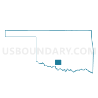
Outline

Summary
| Unique Area Identifier | 655200 |
| Name | Voting District 50 |
| County | Stephens County |
| State | Oklahoma |
| Area (square miles) | 38.13 |
| Land Area (square miles) | 36.39 |
| Water Area (square miles) | 1.75 |
| % of Land Area | 95.42 |
| % of Water Area | 4.58 |
| Latitude of the Internal Point | 34.58588990 |
| Longtitude of the Internal Point | -97.96373690 |
Maps


Graphs
Select a template below for downloading or customizing gragh for Voting District 50, Stephens County, Oklahoma


Neighbors
Neighoring Voting District (by Name) Neighboring Voting District on the Map
- Voting District 1, Stephens County, OK
- Voting District 19, Stephens County, OK
- Voting District 32, Stephens County, OK
- Voting District 33, Stephens County, OK
- Voting District 34, Stephens County, OK
- Voting District 51, Stephens County, OK
- Voting District 53, Stephens County, OK
- Voting District 57, Stephens County, OK
- Voting District 63, Stephens County, OK
Top 10 Neighboring County Subdivision (by Population) Neighboring County Subdivision on the Map
Top 10 Neighboring Place (by Population) Neighboring Place on the Map
- Duncan city, OK (23,431)
- Marlow city, OK (4,662)
- Bray town, OK (1,209)
- Central High town, OK (1,199)
- Empire City town, OK (955)
Top 10 Neighboring Unified School District (by Population) Neighboring Unified School District on the Map
- Duncan Public Schools, OK (23,674)
- Marlow Public Schools, OK (7,227)
- Bray-Doyle Public Schools, OK (2,374)
- Empire Public Schools, OK (2,184)
- Central High Public Schools, OK (2,048)
Top 10 Neighboring State Legislative District Lower Chamber (by Population) Neighboring State Legislative District Lower Chamber on the Map
Top 10 Neighboring State Legislative District Upper Chamber (by Population) Neighboring State Legislative District Upper Chamber on the Map
Top 10 Neighboring 111th Congressional District (by Population) Neighboring 111th Congressional District on the Map
Top 10 Neighboring Census Tract (by Population) Neighboring Census Tract on the Map
- Census Tract 4, Stephens County, OK (5,705)
- Census Tract 1.01, Stephens County, OK (5,437)
- Census Tract 8, Stephens County, OK (5,241)
- Census Tract 9.01, Stephens County, OK (4,641)
- Census Tract 2, Stephens County, OK (3,850)
- Census Tract 9.02, Stephens County, OK (3,836)